Soil Fertility Index
Grundo’s model can ingest satellite data of a target region and estimate the content of organic matter. The model selects relevant wavelengths from the satellite data and performs calculations to quantify the amount of organic matter based on the latest research. Since organic matter and fertility are strongly correlated, we can assess the level of fertility of the soil.
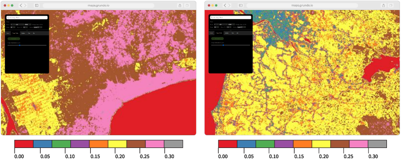
Figure Our Fertility Index applied to two different regions in Indonesia. On the left, we have the region of Kalimantan, where peatlands are present, and potentially the index could be used to identify them (between brown and pink regions). On the right, we have a region with farms where the fertility index could be used for identifying portions of land that are good for agriculture. Currently, the index is based on firm theoretical models and subsequent calibration and ground validation will enhance its accuracy.
Moisture Content Index
Grundo developed a model to determine soil moisture by using satellite data. The model is based on the so-called trapezoidal method and is enhanced by applying superior mathematics, allowing for more analytics insights than what's commonly available in the market.
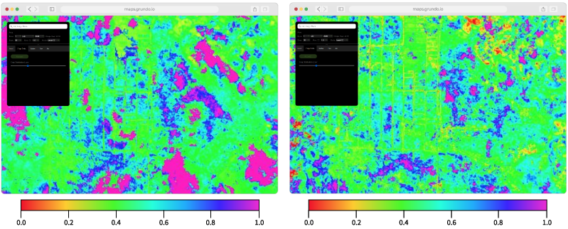
Figure Our in-house Moisture Content Index applied to Central Kalimantan. On the left, we see the index during the rainy season and, on the right, during the dry season. As we can see, on average the index shows a good measure of the moisture content of the soil, and potentially, it can also be used to determine when a portion of peatland has become too dry increasing the risks of catching fire. Currently, the index is based on firm theoretical models and subsequent calibration and ground validation will enhance its accuracy.
 Pesticide Monitoring
Increasing public awareness of the consequences of pesticide and fertilizer use for the environment has put great reputational and regulatory pressure on many organizations. Environmental, government and social responsibility are no longer limited discussions in academic circles and NGOs, companies are expected to disclose and monitor their activities that impact the broader natural and societal environment. Grundo is committed to the cause and has built novel and cost-efficient ways, using remote sensing, to detect chemicals and other hazardous substances that could damage the environment. Our solutions can assess the environmental impact by leveraging high-tech satellite image processing and the latest scientific research.
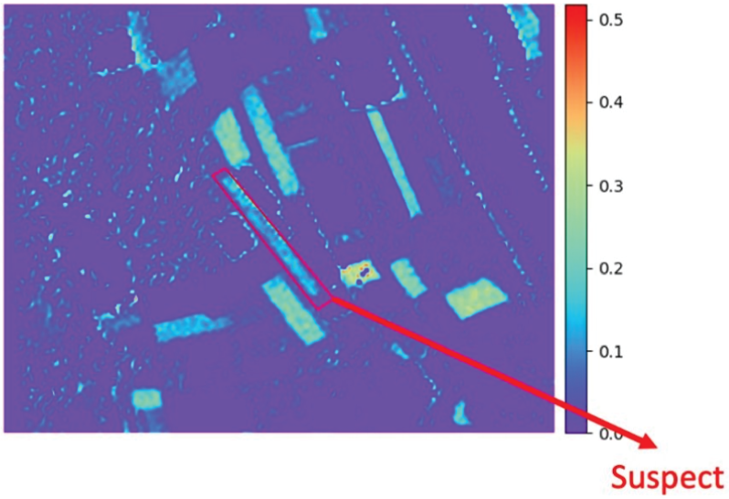
Figure Our methods are capable of detecting pesticide and fertilizer use with the help of satellite image processing by combining both low- and high-resolution imagery and using higher-resolution approximation algorithms when punctually required.
 Machine Learning Crop Classification
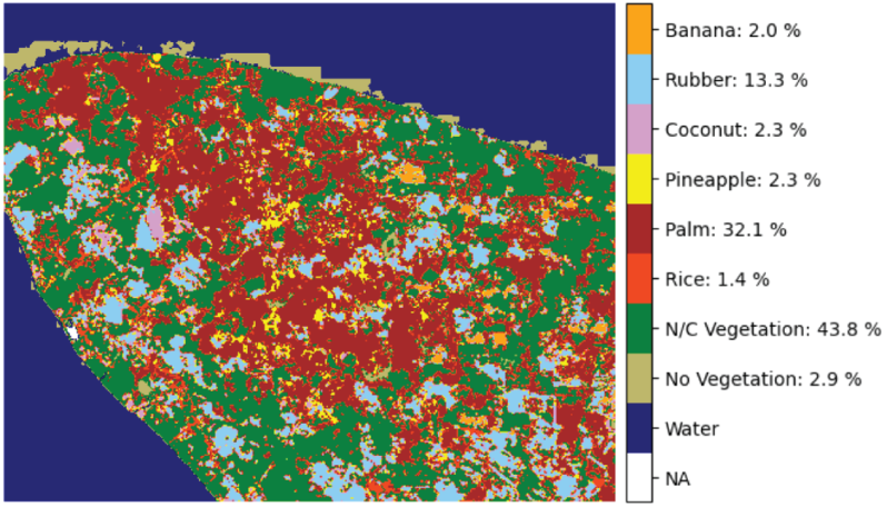
We combine agriculture and sustainability subject matter expertise with computational methods to provide fully customizable crop- and plant-detection capabilities. Our machine learning algorithm for crop classification (a.k.a. Hamilton AI) uses neural networks to detect a broad range of plants, which makes it suitable for monitoring and identifying species at a large-scale. We provide high success detection ratios that might be very specific to your geographic region and also take into consideration all other unique requirements needed for the success of your business.
Figure An early-stage crops-classification example from a remote area in Indonesia.
 Maps Web Portal
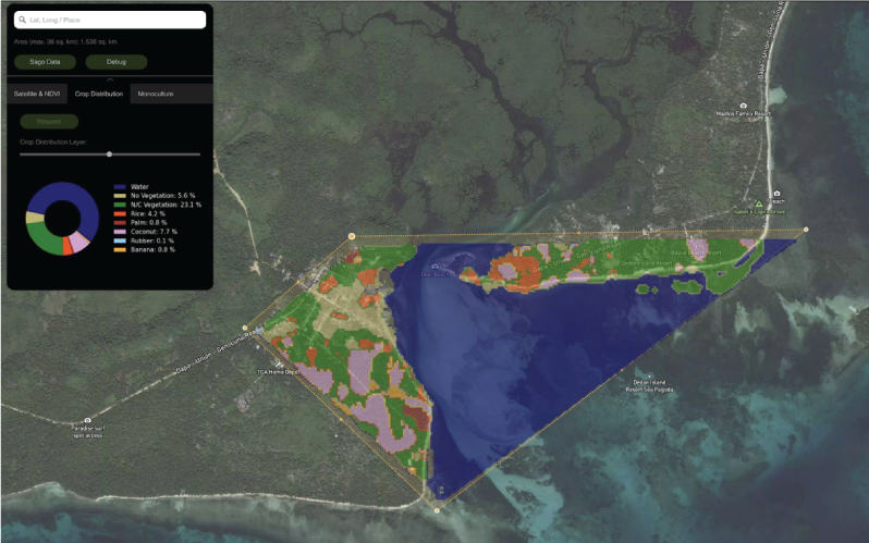
Gundo Maps Web Portal is the culmination of several systems into a single web accessible interface that provides web users direct access to NDVI, Soil Fertility, Crop Distribution map overlays in near real-time. Grundo MWP is also a tool for capturing crop and geo-specific data for custom applications. The system is capable of ingesting unique crop samples that feed into Hamilton AI as training data and subsequent use.
Figure Grundo Maps Portal allows users to apply various analysis through geo-fencing specific areas, in this example, a crop classification render is imposed on the selected area.